
If you are looking for an adventure that combines natural beauty and history, Bueggio, a hamlet of Vilminore di Scalve, is the ideal starting point. This circular route will allow you to discover human ingenuity and the power of nature, while also offering a glimpse into the memories of a tragic disaster.
Starting from Bueggio, at an altitude of 1,052 meters, follow the signs for trail number 410, which begins to climb alongside the Povo stream to the left of the village. The first stop is at Ponte del Gleno (Gleno Bridge), where you will find a picnic area—an ideal spot for a break. Here, take the time to visit the "Marmitte dei Giganti," peculiar rock cavities formed by the erosive action of water and glaciers. These holes, resembling large pots, were thought by locals to be used by giants for cooking their food. Let yourself be captivated by this natural wonder before resuming the path through the forest, where the trees’ shade provides a pleasant coolness.
Starting from Bueggio, at an altitude of 1,052 meters, follow the signs for trail number 410, which begins to climb alongside the Povo stream to the left of the village. The first stop is at Ponte del Gleno (Gleno Bridge), where you will find a picnic area—an ideal spot for a break. Here, take the time to visit the "Marmitte dei Giganti," peculiar rock cavities formed by the erosive action of water and glaciers. These holes, resembling large pots, were thought by locals to be used by giants for cooking their food. Let yourself be captivated by this natural wonder before resuming the path through the forest, where the trees’ shade provides a pleasant coolness.

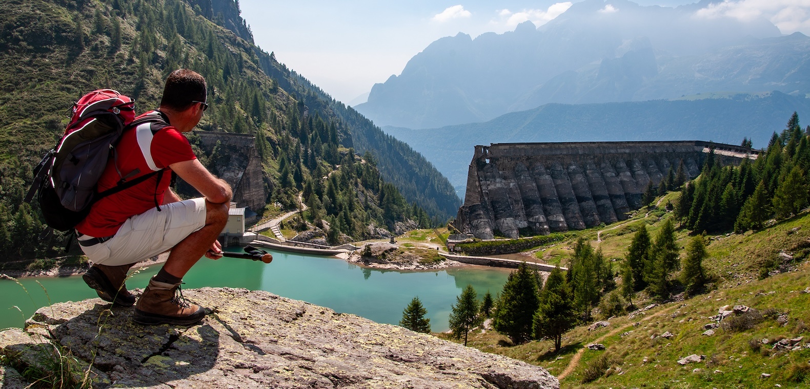
As you continue along the trail, you will reach an altitude of about 1,550 meters, where the remains of the Gleno Dam stand. This structure, which suffered severe damage over fifty years ago, will impress you with its imposing wall. To fully understand the magnitude of the disaster that occurred on December 1, 1923, take a look at the nearby informational panels. The sight of the dam’s arches, which were designed to hold back 6 million cubic meters of water, will make you feel small in the face of both the grandeur of human engineering and the power of nature.
As you continue along the trail, you will reach an altitude of about 1,550 meters, where the remains of the Gleno Dam stand. This structure, which suffered severe damage over fifty years ago, will impress you with its imposing wall. To fully understand the magnitude of the disaster that occurred on December 1, 1923, take a look at the nearby informational panels. The sight of the dam’s arches, which were designed to hold back 6 million cubic meters of water, will make you feel small in the face of both the grandeur of human engineering and the power of nature.

For well-trained hikers, an additional three hours of trekking will lead you to Belviso Pass at an altitude of 2,516 meters, where you can admire the vastness of the entire valley. However, for this hike, you will reach a nearby seasonal refreshment point where you can take a short break or enjoy a complete meal while admiring the surrounding panorama. After resuming the trail, you will arrive at the northernmost point of the Gleno basin. After crossing a wooden bridge, walk along the left side of the lake until you reach the ruins of the dam.
For well-trained hikers, an additional three hours of trekking will lead you to Belviso Pass at an altitude of 2,516 meters, where you can admire the vastness of the entire valley. However, for this hike, you will reach a nearby seasonal refreshment point where you can take a short break or enjoy a complete meal while admiring the surrounding panorama. After resuming the trail, you will arrive at the northernmost point of the Gleno basin. After crossing a wooden bridge, walk along the left side of the lake until you reach the ruins of the dam.

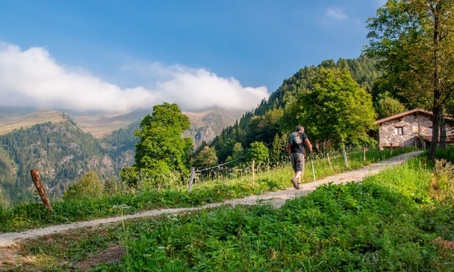
For the return, take trail 411, which leads to Pianezza, part of the Via Decia route. This trail is known for its path through the iron-rich forests. After passing a small, still-operational dam, the trail flattens out and is, in parts, carved into the rock. The descent becomes steep after the water pipes. Once you reach the small square in Pianezza, follow the road for a few hundred meters until you reach the first hairpin turn, where you can rejoin the trail back to Bueggio. This hike offers a fascinating mix of nature and history, taking you through the ruins of the Gleno Dam and the unspoiled beauty of the mountain landscapes. I hope you enjoy this journey and take home unforgettable memories of this magnificent area of the Bergamo region. Enjoy the hike!
For the return, take trail 411, which leads to Pianezza, part of the Via Decia route. This trail is known for its path through the iron-rich forests. After passing a small, still-operational dam, the trail flattens out and is, in parts, carved into the rock. The descent becomes steep after the water pipes. Once you reach the small square in Pianezza, follow the road for a few hundred meters until you reach the first hairpin turn, where you can rejoin the trail back to Bueggio. This hike offers a fascinating mix of nature and history, taking you through the ruins of the Gleno Dam and the unspoiled beauty of the mountain landscapes. I hope you enjoy this journey and take home unforgettable memories of this magnificent area of the Bergamo region. Enjoy the hike!
Copyright © 2024
Agenzia per lo sviluppo e la Promozione Turistica della Provincia di Bergamo scarl
Sede legale: Via T. Tasso 8 – 24121 Bergamo | Sede operativa: Viale Vittorio Emanuele II, 20 - 24121 Bergamo
C.F. e P.Iva 02910070164 e reg. imprese cciaa di Bergamo 02910070164
Privacy Policy
- Credits

 visitbergamo_official
 Visitbergamo
 Turismobergamo
 Turismobergamo
 + 39 333 1850393