
If you are looking for an adventure that combines natural beauty and history, Bueggio, a hamlet of Vilminore di Scalve, is the ideal starting point.
This loop trail will allow you to discover human ingenuity and the power of nature, while also offering a dive into the memories of a tragic disaster.
Starting in Bueggio, at an elevation of 1,052 meters, follow the signs for trail number 410, which starts up the Povo stream on the left side of the village.
The first stop is at Ponte del Gleno, where you will find an equipped picnic area ideal for a rest.
Here you can take advantage of the time available to visit the “Marmitte dei giganti,” peculiar rock cavities formed by the erosive action of water and glaciers.
These holes, which resemble large pots, are so named because in popular tradition they were thought to be used by giants to cook their food.
Let yourself be enchanted by this natural spectacle and then resume your walk in the forest, where the shade of the trees will provide pleasant coolness.
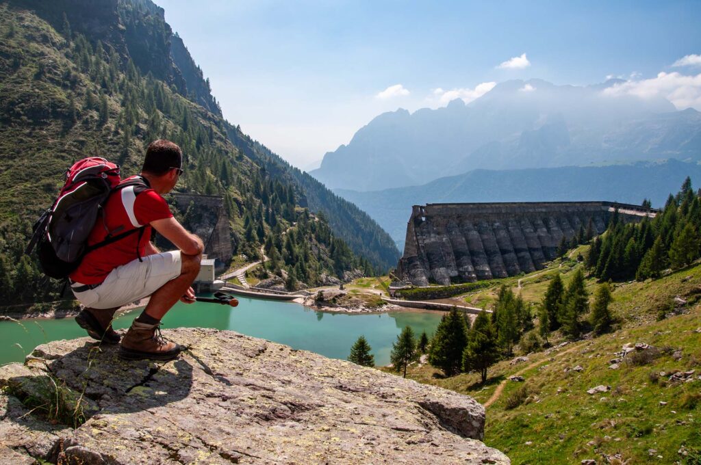
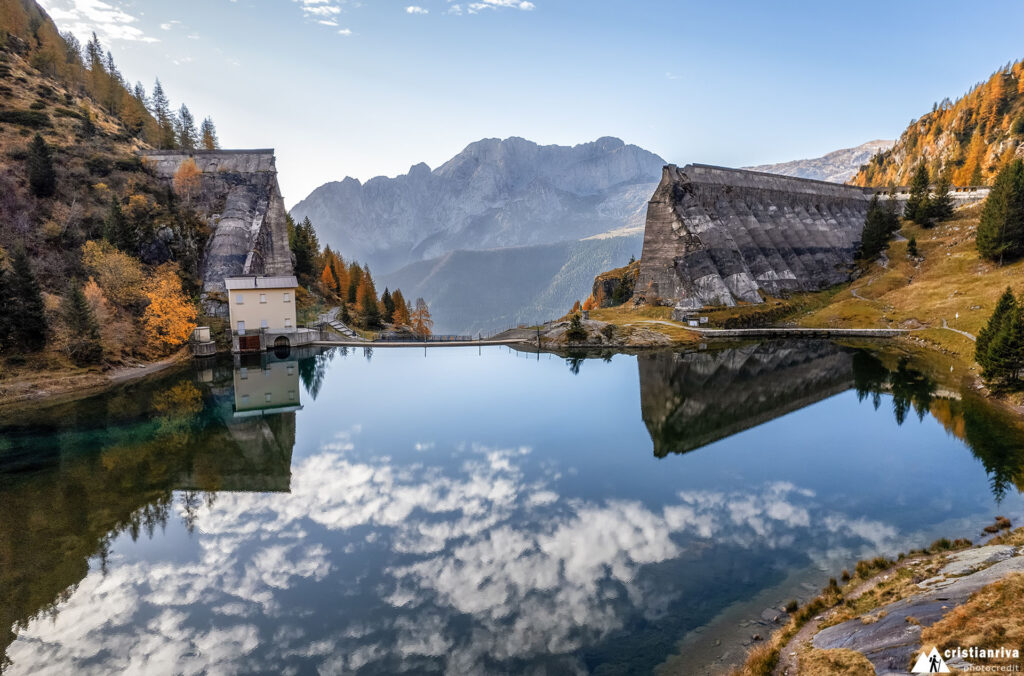
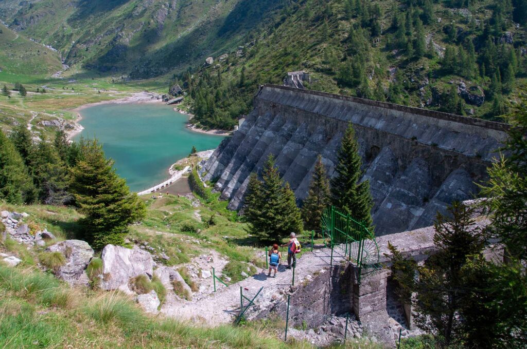
Continuing along the trail, you will reach an elevation of about 1,550 meters, where what remains of the Gleno Dam stands.
This structure, which suffered severe damage over fifty years ago, will impress you with its imposing wall.
To fully understand the magnitude of the disaster that occurred on December 1, 1923, observe the explanatory panels located nearby.
The sight of the dam’s arches, designed to hold the 6 million cubic meters of water, will make you feel small in the face of the grandeur of the work and the force of nature.
Continuing along the trail, the trained hiker could, with another three hours of good walking, reach the Belviso Pass, at an altitude of 2516 meters, from which to admire the immensity of the entire valley; we, on the other hand, briefly reach the seasonal refreshment point above, where you can take a short break or enjoy a full lunch while admiring the surrounding panorama.
Resuming your walk, reach the northernmost point of the Gleno reservoir and, crossing the small wooden bridge, walk along the left orographic bank of the lake to the ruins of the dam.
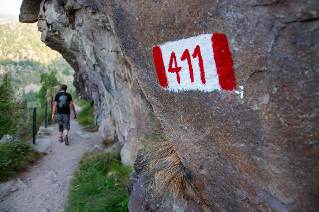
For the return trip, take Trail 411 that leads up to Pianezza, part of the Via Decia Trail.
This trail is known for its route through ironwoods.
After passing a small dam that is still in operation, the trail becomes flat and in places carved into the rock.
The descent becomes steep after the water pipes.
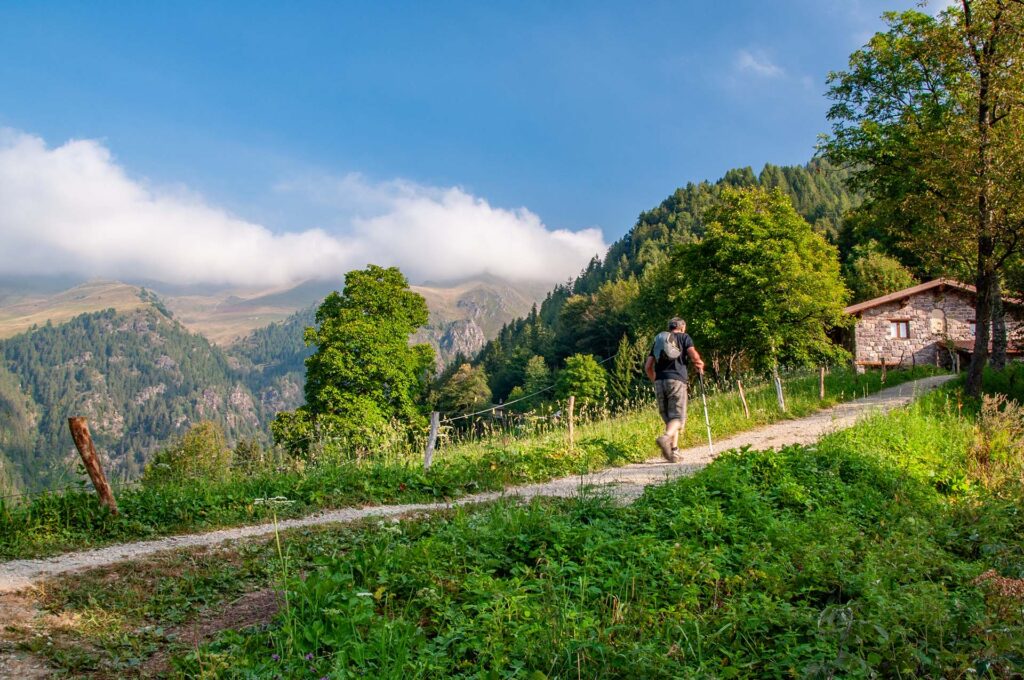
When you reach the small square in Pianezza, follow the road for a few hundred meters to the first hairpin bend, where you can pick up the trail to Bueggio.
This hike offers a fascinating mix of nature and history, between the ruins of the Gleno Dam and the unspoiled beauty of the mountain landscapes.
I hope you will enjoy this trip and take with you unforgettable memories of this magnificent area of the Bergamo territory.
Enjoy your excursion!